 Travel
to GET west terminus Travel
to GET west terminus
The
Grand Enchantment Trail begins east of Phoenix at the First Water Trailhead on
the Tonto National Forest. This trailhead is easy to reach from downtown Phoenix,
Phoenix Sky Harbor international airport, and the Greyhound bus terminal adjacent
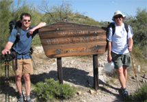
to Sky Harbor. (At right, hikers Li & Michael starting east from the trailhead.
Photo by Li Brannfors.) Directions
to GET west terminus: First
Water Trailhead is located about 45 miles east of downtown Phoenix. From Phoenix
Sky Harbor Airport, exit onto Washington St eastbound. Pick up the 202 freeway
east to US 60 east to exit 196 / Idaho Rd. Turn left, following Idaho Rd north
through four traffic lights. Along the way, pass a Super 8 motel, a few convenience
stores (for water, possibly HEET, etc.), a Walgreens pharmacy (Bic lighter, sunscreen,
etc.), and several restaurants nearby. At the 5th light, turn right, northeast,
onto Apache Trail / State Route 88. Pass Goldfield ghost town / tourist attraction,
and then (at around 5 miles from Idaho Rd jct) a signed turnoff to Lost Dutchman
State Park on right. Continue on Apache Trail less than a half mile farther, then
turn right onto graded dirt FR 78 at sign for "First Water Trailhead." Your driver
may opt not to continue farther, although the road is usually passable for passenger
vehicles except following summer monsoon flash floods. At ~2.3 miles on FR 78,
find First Water equestrian parking on the left. Here a spur trail heads east,
or continue on the road ~0.6 mile farther to First Water Trailhead hiker parking
and the GET west terminus. Toilet facilities are here, as well as a hiker register
and information kiosk, but no water is available. (First probable water along
the trail is Charlebois Spring about 9 miles away.)
Back
to GET Town Guide Home |


 TOWN
GUIDE
TOWN
GUIDE