 |
|
Mogollon
Rim Trail
Mapset & Resource Bundle |
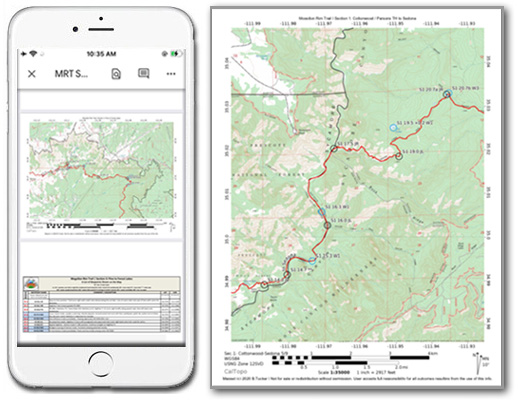
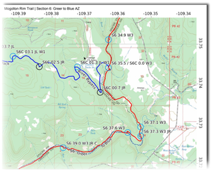
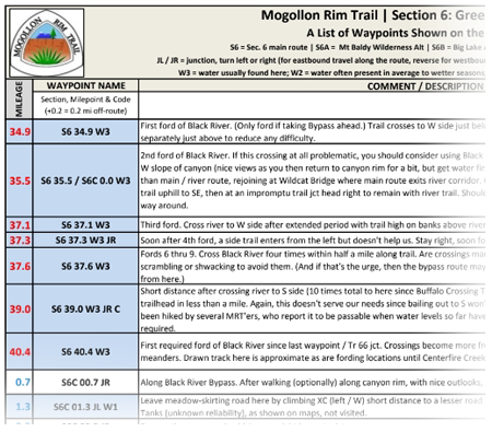
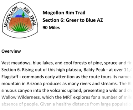
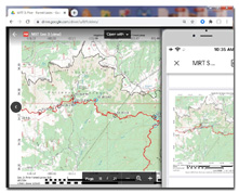
Meticulously researched and field-verified, this all-inclusive digital resource contains everything needed for experienced long-distance hikers to traverse the new Mogollon Rim Trail long distance hiking route across Arizona's famed Rim Country. Here you'll find over 70 high-resolution, detailed 1:35,000 scale PDF map pages featuring the most current, accurate base map imagery available from Caltopo and US Forest Service. Together, the maps illustrate the entire MRT route and its terrain, along with mileages, navigational info, water sources, resupply locations, and much more, all viewable and printable from your computer's desktop, a tablet or smartphone. This mapset also contains overview maps, elevation profiles, and section descriptions, together describing the route's location, length, terrain, and important information between each of its resupply points. All map and data pages are in the common PDF format and are standard letter-size (8.5 x 11") for home printing as well as easy uploading to document printing websites such as FedEx Office. Also included with purchase High
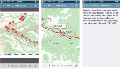
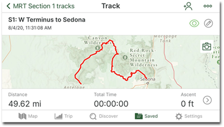
accuracy, field-recorded GPS tracks and waypoints for the entire route, specifically
curated for and ready for use within the free Avenza app as well as the popular
Gaia GPS mobile app. PDF Town Guide, detailing important resupply and town-day information for each of the route's town stops. Access to community content in the form of online journals, trail notes, and digital media. Gain inspiration and perspective from those who've already hiked the MRT as you prepare for your own hike. Stay
on top of changes to the route with timely updates and a mapset that remains current
into the future, all from a single download link provided with your one-time purchase. System requirements: Digital download (300MB) can be accessed in the Cloud via PC, Mac, Android or iOS. Color InkJet or LaserJet printer recommended if printing at home. Adobe Acrobat Reader recommended for viewing and home printing of PDF maps. Avenza is a free app available for iOS and Android that can optionally be used for GPS-based navigation with our Avenza-compatible PDF maps. GaiaGPS is a subscription-based app for iOS and Android that can optionally be used for GPS-based navigation with our Gaia-ready folder of tracks and waypoints.
Disclaimer: While it is our hope and endeavor that the M.R.T. digital mapset will allow experienced users to avoid most navigational problems and will contribute to a rewarding adventure along the route, we do not guarantee the 100% accuracy of these maps and GPS data and other information provided, and assume no responsibility for their use or misuse. Hiking and backpacking are inherently risky activities, so be sure to use these maps as part of an overall approach to maintaining safety in the backcountry, and do not assume their endorsement of a particular road, trail, or creek crossing, etc. Conditions in the field can change, sometimes quickly, and property boundaries can be redrawn to exclude public access. In short, use the maps and benefit from them, but use your skills and your awareness too. And always keep your options open when determining the safest and most practical direction of travel.
Copyright © 2024 Simblissity Ultralight Designs |
| ||||||||||||||||||||||||||||||||||||||||||||||