 POLVADERA
NM POLVADERA
NM
Trail
miles from west terminus: 615
Distance from GET:
1.1 mi S & E via
frontage rd
/ 0.9 mi S & W via
Canal Rd
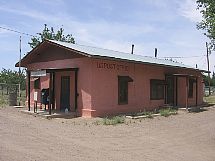
The
Spanish word Polvadera means "dusty," and although the interstate corridor that
bumps up against this otherwise peaceful hamlet may appear dust-coated and desertified,
the nearby Rio Grande is actually surrounded by stately cottonwoods and is surprisingly
lush. Polvadera lies at the edge of the Rio Grande bosque, another Spanish word,
meaning "riverside woods." Agriculture and ranching, permitted by an elaborate
network of drainage canals, are the primary ways of life here; the interstate
and its culture actually bypasses the community itself. Polvadera offers little
more than a post office, although the village of Lemitar, 5 miles south via a
frontage road, has a full-service truck stop and cafe. Five miles farther south
lies the larger town of Socorro (Spanish for "help"), reachable by taxi or rideshare
and offering most services including low-cost public transportation to and from
Albuquerque. Socorro is also available as a walk-through resupply option via the
Magdalena Mountains - Socorro Resupply Alternate Route. See the Topo Mapset for
details.
Back
to GET Town Guide Home |


 TOWN
GUIDE
TOWN
GUIDE